Blue Jay Point is one of my family’s favorite parks. Playground, hiking trails, sports fields, environmental education – Blue Jay Point has it all.
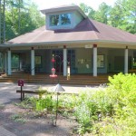
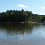
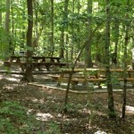
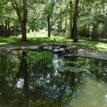
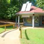
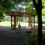
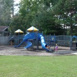
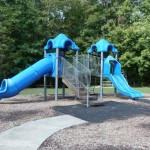
This 236-acre Wake County park is located on the shores of Falls Lake, just off Six Forks Road. The park offers a good balance of natural areas and outdoor play. The large playground is split into age-appropriate sections. A quick hike from the playground will take you to the lake around a short loop trail. The Blue Jay Center is home to environmental education displays and programming. A garden area and study pond are located near the front of the park. The park’s soccer and baseball fields are popular and well-maintained.
In addition to the normal car entrance, the park is accessible via the Falls Lake trail that follows the west shore of Falls Lake from the dam at the Neuse River to just north of I-85.
3200 Pleasant Union Church Rd
Raleigh, NC 27614
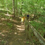
We typically start our visit to BJP with a hike that ends (at our kids’ insistence, of course!) at the playground. We park at the playground, then walk across the nearby soccer field and past the Blue Jay Center and pond area. The trail begins near the park’s entrance. Follow the blue blazes of the Beaver Point trail (overlapping part of the yellow-blazed Azalea Loop) toward the lake. Just before you reach the lake, you’ll notice a white-blazed trail intersecting the Beaver Point trail. This is a good spot to check out the lake before turning to the left and following the Falls Lake Trail’s white blazes. You’ll cross the blue-blazed Blue Jay Point trail (all lake-access trails in the park have blue blazes) before reaching the yellow blazes of the Laurel Loop trail. You can take the Lauren Loop in either direction to return to the playground. The full hike is probably around 2 miles. For more detail, check out the park brochure. The map is on the last page.
If you’re a more adventurous hiker, in addition to the park trails, you should check out the Falls Lake Trail. I’ll post more about this trail later. It’s part of the NC Mountains to Sea trail. Bob Steinbeiser has posted a nice map of the trail on his site that’s more up-to-date than the “official” map.